What is field fragmentation, and why it matters for satellite crop monitoring
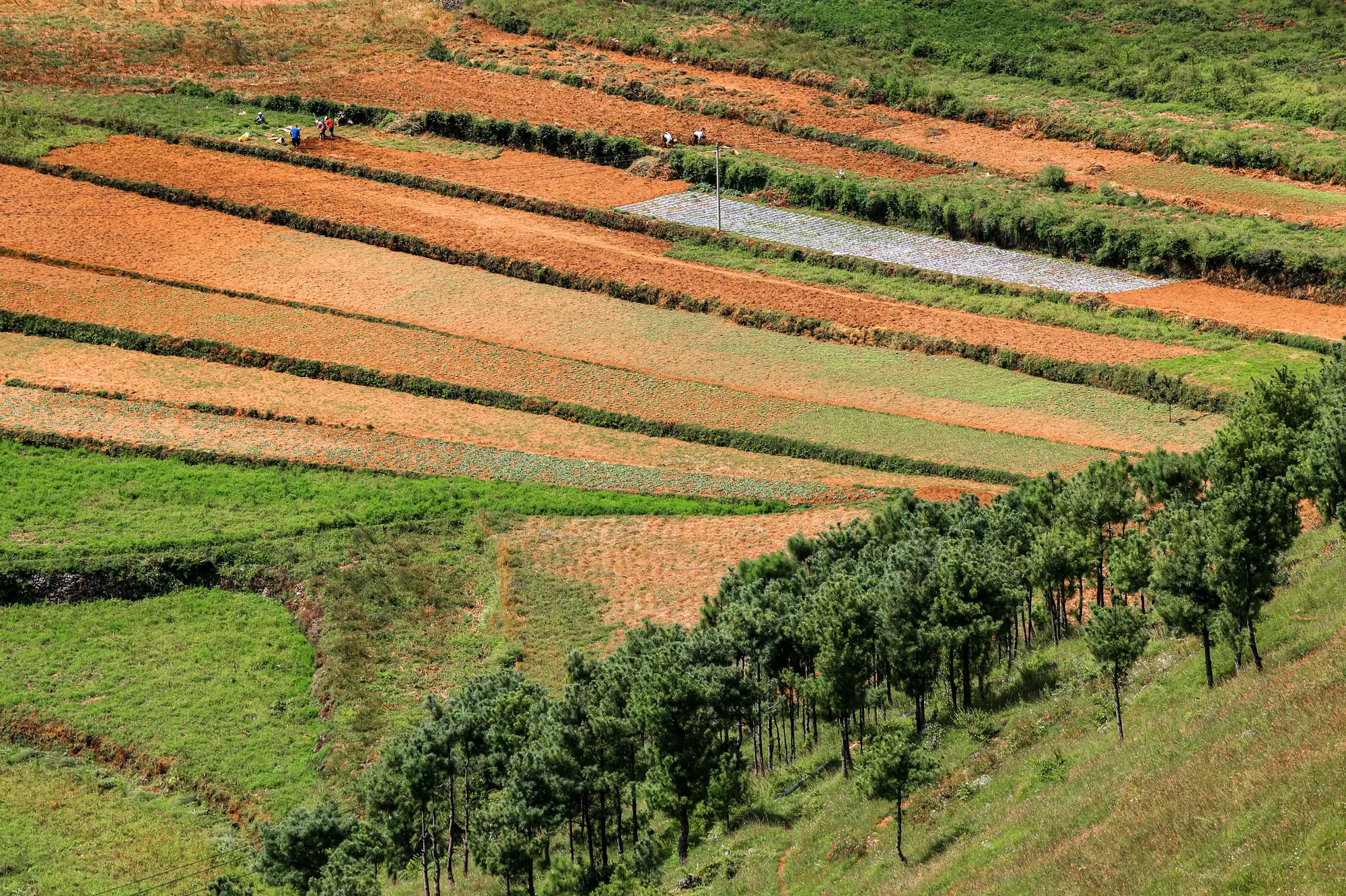
If you've pulled up an NDVI layer for an advisory region and noticed that three neighboring farmers with three different crops, three different planting dates, and three different levels of stress all show the same shade of green, you've met field fragmentation head-on.
Field fragmentation is just the technical term for something every advisory agronomist already knows from walking the land: in smallholder regions, farms aren't laid out in 40-hectare center-pivot blocks. They're a patchwork of half-hectare plots, strip fields along a contour, and odd-shaped parcels split by inheritance over a generation or two. A single wide-swath satellite pass with a 10 to 30 meter ground sample distance can't tell those plots apart, because several of them fit inside one pixel.
How pixel averaging flattens the data
A satellite pixel doesn't choose a crop to report on. It reports the average reflectance of everything inside its footprint. When that footprint covers one grower's drought-stressed maize, the neighbor's well-irrigated beans, a strip of bare fallow, and a hedgerow, the output you get is a blend. Not a wrong number exactly, just a number that doesn't belong to any one field.
For a regional index that's meant to flag broad trends across a watershed or a district, that blending is tolerable. For an advisory service trying to decide which specific households need a visit this week, it's close to useless. The index can show a mid-range reading for a pixel that actually contains one field doing fine and one field failing, and an agronomist reading that number has no way to separate the two without walking out there anyway.
Parcel size versus pixel size: where the math stops working
The rule of thumb is simple: once an individual parcel drops below the ground sample distance of the sensor, it stops being resolvable on its own. A field that's two or three pixels wide might still show some real signal. A field that's a fraction of one pixel is just contributing noise to whatever else shares that square.
This is the exact situation in most smallholder regions. Average parcel sizes in these areas routinely run under a hectare, sometimes well under, while a lot of operational multispectral satellites deliver imagery at 10, 20, or 30 meters per pixel. Do the geometry and you'll find dozens of fields sharing a handful of pixels across a typical advisory catchment.
It's worth being precise about why this is a monitoring problem and not just an inconvenience. Fragmentation doesn't just reduce resolution evenly across the board. It reduces it unevenly, depending on how a given parcel happens to sit relative to the pixel grid. Two fields of identical size and identical crop stress can return different index values purely because one straddles a pixel boundary and one doesn't. That's a hard thing to explain to a field officer who's asking why the satellite says one grower's plot is fine when the officer just walked it and saw wilting leaves.
Why fusion, not just finer resolution, is the fix
The obvious answer sounds simple: use a finer-resolution sensor. In practice, that trade-off cuts against cadence, cost, or coverage, which is exactly why wide-swath multispectral platforms are the backbone of most weekly monitoring programs in the first place. The more workable path is fusing that wide-swath pass with sharper looks, so the weekly cadence survives and the output gets pulled back down to something closer to field scale instead of pixel scale.
That's the gap Field Scale Index is built around, and it's an early-access product rather than a finished national layer. The pipeline is being built out field type by field type. If your advisory catchment is one of the field types already covered, a weekly reading sized to the actual parcel beats a regional average that smooths your scattered smallholder fields into a single, unhelpful number.
Get in touch if you want to see whether your region is on that build-out list.