What counts as a field boundary when pulling a vegetation index reading
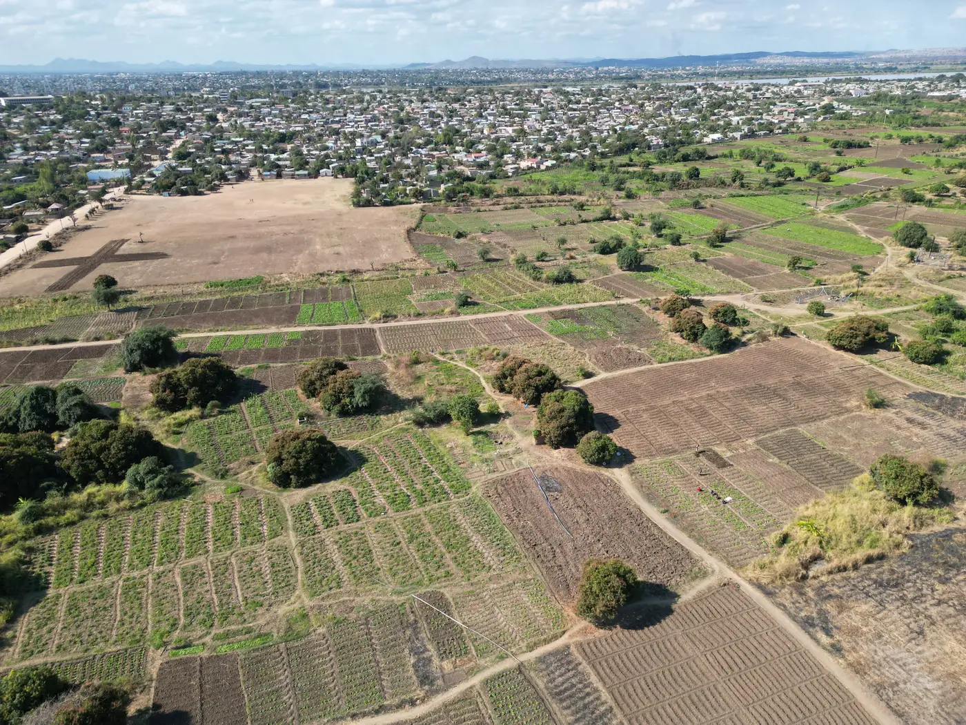
A field boundary sounds like a simple thing until you're the one drawing the polygon. Ask ten agronomists where a field "ends" and you'll get ten slightly different lines: some trace the plowed edge, some include the access track, some stop short of the irrigation furrow by a meter or two. None of them are wrong exactly. But when that polygon is what a vegetation index gets averaged over, the line you draw decides what number comes back.
The boundary is the sampling unit, not the property line
A field boundary, for index purposes, is simply the area you want averaged into one reading, independent of any legal or cadastral line. That distinction matters more on smallholder plots than on a quarter-section pivot, because the margin for error is so much smaller relative to the plot itself.
On a two-hectare maize plot, a boundary that's off by three meters on one side barely changes the average. On a 0.3-hectare vegetable plot, that same three-meter slip can pull in a stretch of bare path, a neighboring crop, or a drainage ditch, and that one strip can shift the whole reading. So the working rule most advisors use: draw to the actual planted canopy, not to the fence, the hedgerow, or the parcel record. Leave the access track out. Leave the field margin's weeds out if they're not part of what you're scouting. The polygon should match what's growing, not what's owned.
Drawing the AOI for a plot smaller than the source pixel
This is where it gets specific to small plots. If your source imagery runs 10 to 30 meters per pixel and your plot is a hectare or less, the field footprint and the pixel footprint are close to the same size. One pixel edge in the wrong place and your "field average" is really a blend of your field and whatever's next door, fallow ground, a different crop, a farm track.
A few things that hold up in practice:
- Buffer in from the outer edge by a few meters on all sides rather than tracing right to the crop line. This keeps mixed boundary pixels out of the polygon rather than averaging them in.
- Treat windbreaks, terraces, and shared access paths as outside the AOI even if they sit inside the deeded parcel. They don't carry the crop signal you're pulling the reading for.
- If the plot has two distinct crops or a fallow strip within it, that's two AOIs, not one. One polygon per crop stand, even if the farmer thinks of it as a single field.
- Redraw after any replanting or boundary shift. A polygon traced last season against this season's planting lines will pick up edge noise that has nothing to do with crop condition.
When the boundary itself is the problem
Sometimes the honest answer is that a plot is too small or too irregular for a clean index reading, no matter how carefully the polygon is drawn, because the source pixel is simply bigger than the plot itself. That's the gap Field Scale Index is built around: fusing a wide-swath multispectral pass with a sharper look so a small polygon returns a reading scaled to the plot instead of a few blended pixels standing in for a whole stand and its neighbors. It's early access, built out one field type at a time rather than as a finished national layer, which makes it worth a look specifically where boundary drawing has been fighting the pixel size all along: over a weekly per-plot reading instead of a regional average smeared across plots that don't belong together.
A quick checklist for drawing the polygon
Before you save an AOI, run through this: Does the line follow the crop stand or the parcel record? Does it buffer away from tracks, ditches, and windbreaks? Is it one polygon per distinct stand, not per deeded field? Has it been redrawn since the last planting change? Get those four right and most of the edge-pixel problems on small plots sort themselves out before the index reading ever gets pulled.
If you're drawing boundaries on plots that keep getting swallowed by mixed pixels, it's worth joining the Field Scale Index waitlist to see field-scale readings as the fusion pipeline rolls out.